Sometime in late September, as the hint of Autumn set in, I began entertaining thoughts of going high up in the Himalayas. For me, what qualifies as going ‘high up’ is that I must find myself at a place well above the treeline (>3,000 meters) and within striking distance of mountain summits that are >5,000 meters. This is just mumbo-jumbo for saying that I want to go high up in the Himalayan river valleys. Badrinath was the first place I had in mind. I had been there just once as a young teenager back in 1994, and the place had a profound impact on me. The travel through narrow and deep gorges, with Alaknanda flowing beneath in a noisy rush, and the almost sudden and dramatic opening up of the valley, led to a place that resembled a grand maidan with the high Himalayas at a striking distance. 25 years later, in 2019, we were passing Govindghat, on our way back from the Valley of Flowers and Hemkund Sahib trek, but didn’t consider going to Badrinath, which was quite close, due to a paucity of time and inclement weather.
All this background to say that there was an unrelenting urge to find myself back in the Himalayas. Right from my early travels to Nainital (1987), Kashmir (1988), and Badrinath/Kedarnath (1994), I have always felt it to be my home – for me that geography is sacred, and nothing could match its beauty. It is a place that has given me immense joy, and if I stay away for too long, there will be something that will tug me back.
This chemistry makes me plot a visit every few months or so. So this time it was Badrinath, but then I decided to go further up the Dhauliganga valley, up to Niti valley. I think the trigger was the book on “The Great Himalayan Ascent” by Frank Smythe that I was reading – it has three parts: ascents of Kanchenjunga, Kamet, and Camp Six (high camp before Mt. Everest’s summit push). Authored by Frank S. Smythe, while it’s peppered with humor and well-written, the long descriptions of mountaineering can get quite technical and boring in places. What was of my interest, though, was that in the chapter on Kamet, the author describes his “marches” from Ranikhet to Niti village, and then to Kamet thereon. From Ranikhet, he crosses the Pinder watershed and then the Nandakini watershed (some part of this route overlaps with Nanda Raj Jat Yatra) and takes Curzon’s trail to Kuari pass, descending to Suraithota beyond the confluence of Dhauliganga and Rishiganga in Reni.
Delhi to Joshimath
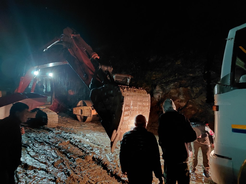
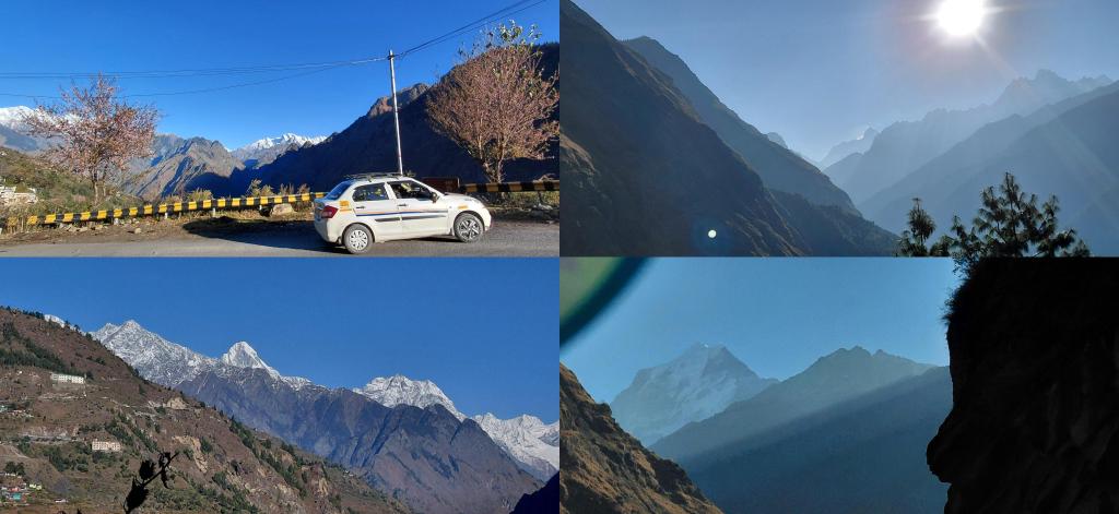
So, I finally left Delhi on the evening of 3rd November and reached Joshimath on the night of the 4th. It would have been an uneventful journey but for the last 10 km near the Vriddha Badri temple, where our bus got stuck in the muddy slush on the road caused by the rains. After about an hour of struggle, which included failed attempts by some of the passengers, including me, who alighted in the steady drizzle to push the bus out of the slush. Such patches will almost always have a crane to put things back in order, but the operator was missing. Once he was back (which was after an hour’s wait), it took no more than 10 minutes to sort things out. Finally, I arrived at around 8 and checked into a small lodge for INR 500. The delay necessitated some plan swapping–so now I was going to Niti Valley on the 5th and do the Kuari trek on the 6th and 7th.
Into the Dhauliganga valley
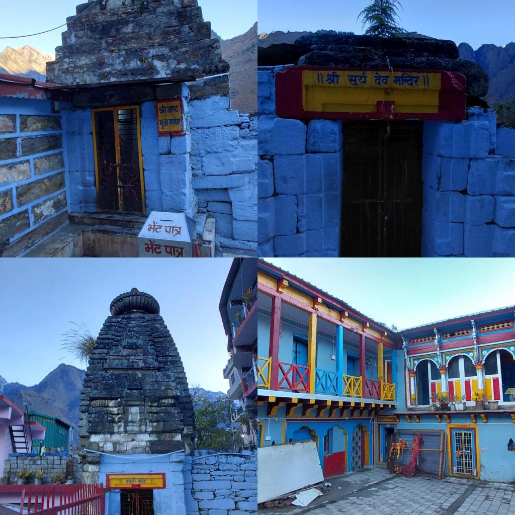
‘Leave as early as possible’ is a useful maxim for travels, and I deployed it on day 1. Even while the driver was reluctant, I ensured that he was at my lodge at 7. Thankfully he made it on time, and we made our first pit stop at the Narsingh temple in Joshimath town. This is also the winter seat of the Badrinath idol. I found the new temple unimpressive and lacking character; however, there are several ancient temples in its periphery, almost merging into the thick neighborhoods around the temple complex.
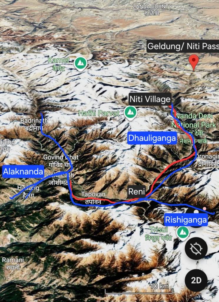
We drove out of Joshimath’s lower Bazaar area and, after the customary petrol refill, made our way towards Niti Valley. We had to go up the Dhauliganga valley, right up to the last village near the Tibet border- Niti, a village inhabited by the Bhotias who traded with Tibetans until the 1962 China war put an abrupt end to that centuries-old trade. The Niti pass is close to the last roadhead, Geldung which is 24 Kms from the Niti village.
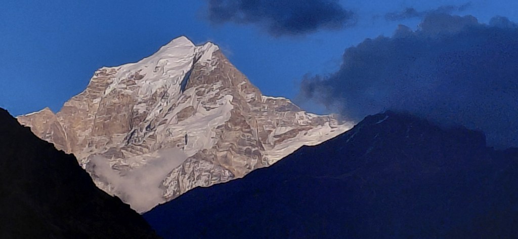
The road from Joshimath to Tapovan winds down to the Dhauliganga river below. Just few kilometers down the road from , once get fleeting views of Mt. Nanda Devi, while Mt. Dronagiri is a constant towering presence. One also gets to see the Nilkantha peak with Joshimath town in the foreground.
A few kilometers from Tapovan is the Reni village at the confluence Rishiganga and Dhauliganga. This place is most remembered as the birthplace of Chipko movement. One of the leading lights of that movement Chandi Prasad Bhat is 91 and still lives in Gopeshwar. I got introduced to the works of Dr. Shekhar Pathak, who has produced one of the authoritative works (The Chipko Movement: A People’s history) on the Chipko movement while I was researching for this trip. Some of his public lectures like this on Himalayan ecology and lectures are unmissable for anyone interested in topic. I also got introduced to Ram Chandra Guha’s book, largely adapted from his doctoral thesis (The Unquiet Woods).
For all its historical importance of the place, I barely stayed at this place. I was eager to reach Niti at the earliest. What I remember is the roaring Rishi Ganga flowing down a steep Rishiganga gorge on the right before draining into Dhauliganga down below. The view up that gorge was magnificent – what caused the awe was also the knowledge that I was looking at the only outlet from the Nanda Devi Sanctuary, a glacial basin housing Nanda Devi peak. For more on that do watch this video. The place was in the news in 2021 disaster when a GLOF at the upper reached of the Rishiganga valley left a trail of disaster killed more than 300 killed- the Tapovan dam site was the worst affected.
After Rishiganga, as we drive up along the Dhauliganga, we enter Bhotia territory. We drive past Lata and a few more villages up till we Suraithota- where we stopover for breakfast.This is the same village that finds mention in Smythe’s book as their point of arrival in the Niti valley when coming down from Kuari Pass on Curzon’s trail. These villages remain inhabited even during the winter months, in contrast to the villages further up the valley, where the inhabitants leave during winters.
The Gorge and the opening valley
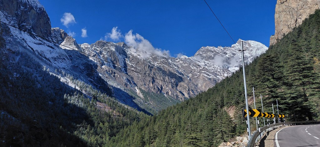
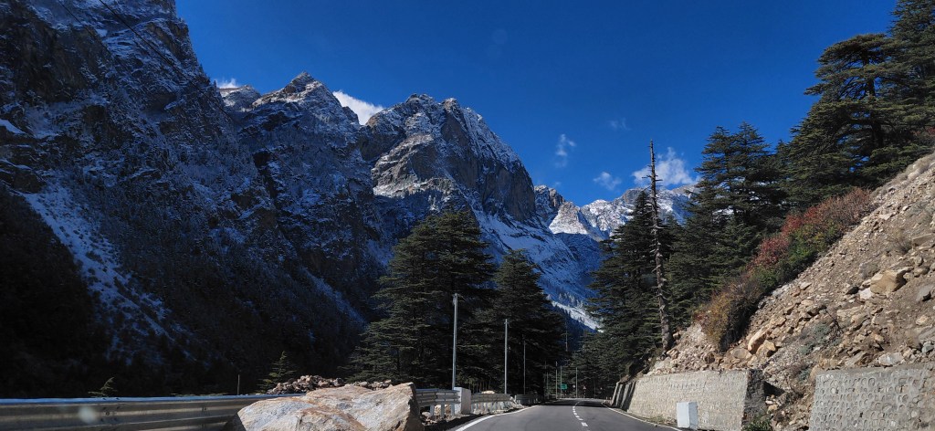
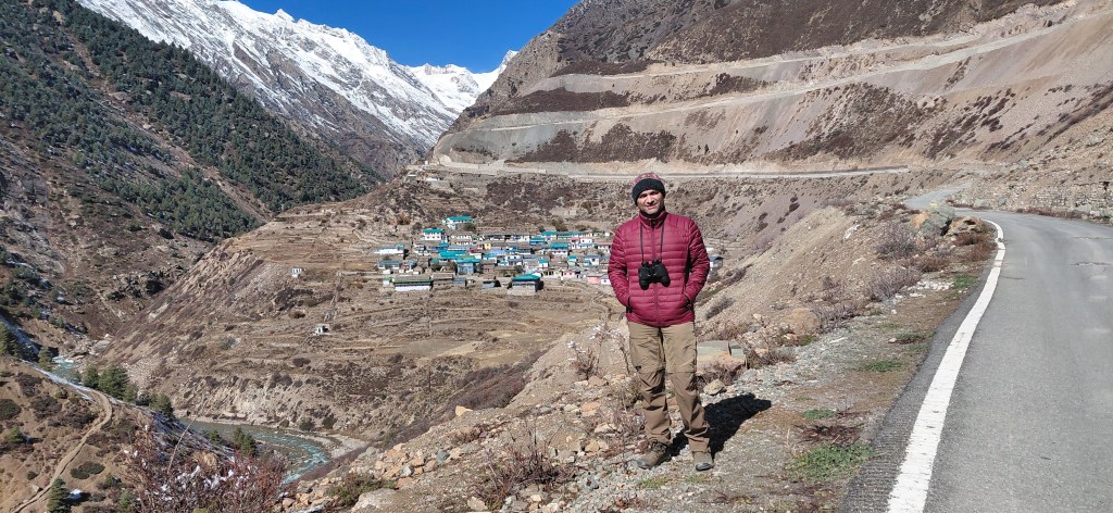
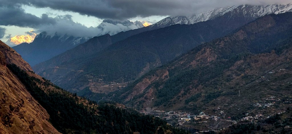
The section from Suraithota to Malari has one of the most stunning landscapes I have ever seen. The Dhauliganga gorge gets narrower, with the cliffs on either sides rising heavenwards. The road for the most part stays on the right bank of Dhauliganga as we gain altitude. While the whole scenery was stunning, one image that will stay with me for a long time is that of Lampak peak. I lost exact count of the Bhotia villages after Suraithota, but it seems there are many of them. I was pleasantly surprised to learn from my driver cum co-traveller that Bhotias have done well – they have wisely used the benefits accorded to them under Scheduled Tribes status – while many from the community are part of the State government jobs, they continue to hold their land and maintain some semblance of traditional living. Their womenfolk can be spotted in black gowns, scarf and heavy jewellery across towns in Uttarakhand esp. during winters.
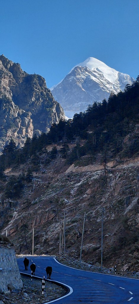
Just before Malari there’s a scenic bridge and we cross over to the left bank of Dhauliganga. There is one final major ascent through multiple loops and we enter the Malar valley. The valley almost dramatically opens up. Nothing prepares you for this dramatic shift in the scenery.
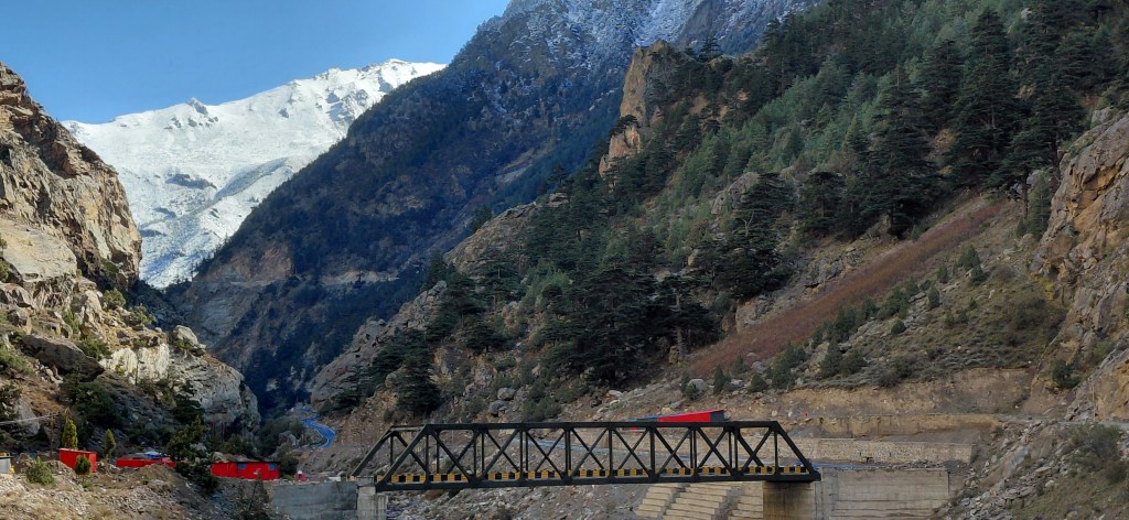
There were some anxious moments as we were stopped at an Army post and told not to go ahead. The reason given was that there was snow ahead and the DM had restricted vehicle movement. I could sense that the orders were somewhat half-serious, more in the nature of reminding us who was in charge than an actual concern for public safety. But this was enough for my driver to lose all his chirpiness, and he remained cautious all the way up to Niti Valley from there. I had to reassure him that there was no need to be fearful.
In any case, while Malari has now been reduced to a border outpost, it must once have been a key connector for various routes to Tibet before the 1962 Indo-China war. This video by Harshit Rautela is a must-watch for anyone interested in the region to the northeast of Malari along Girthi Ganga.
Upper Niti Valley
It was around noon, that part of the day when mountains are at their dullest – the sun is overhead, and the shadows are minimal. It is as if nature is calling to slow down and perhaps take a nap. Just as I was settling into the soporific calm around me, we entered the magical territory of Rewal Chak. We were now on the left bank of our companion, the Dhauliganga. Smythe mentions that this area has an uncanny resemblance to the Gasterntal Valley in Switzerland. I googled the pictures and found the resemblance striking indeed.
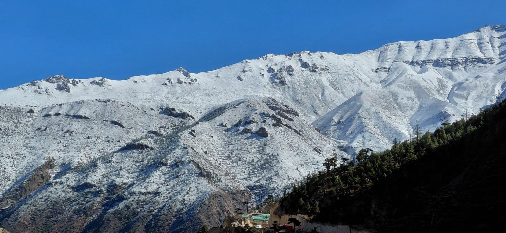
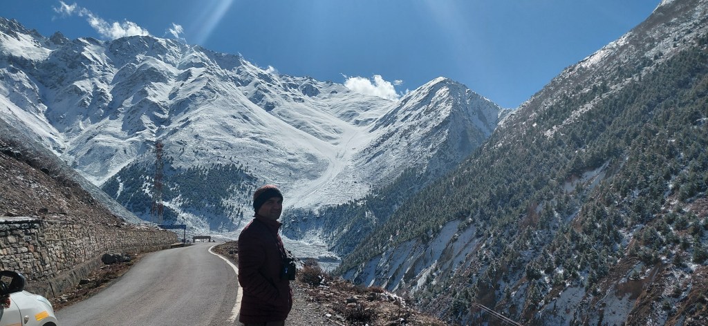
The drive from Malari to Bampa and onwards to Ghamshali was beautiful. The valley was broad, the skyline hemmed in by huge mountains on all sides, which looked like massive granite blocks set with snow atop them. Both the places are small villages with significant military presence.
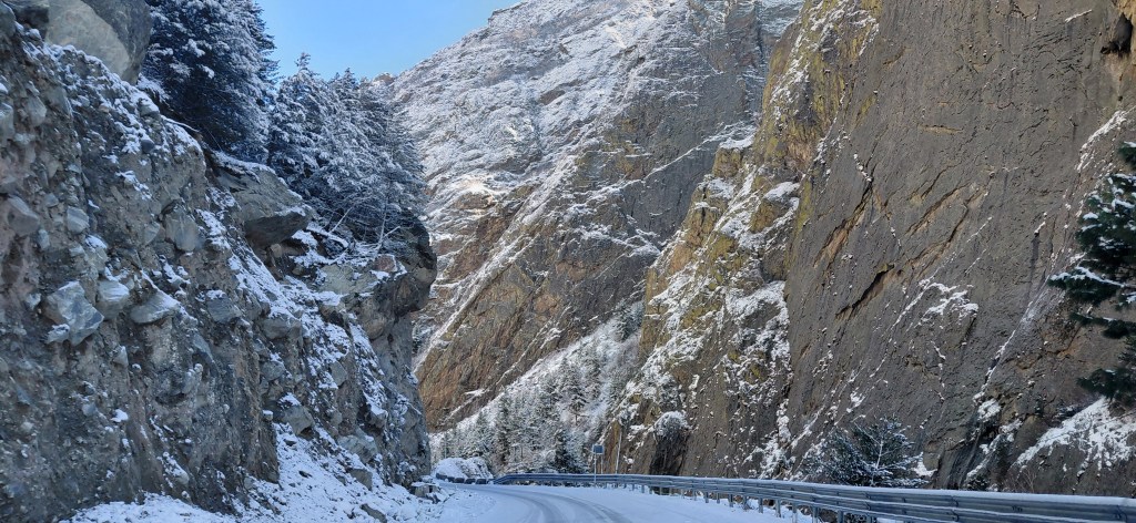
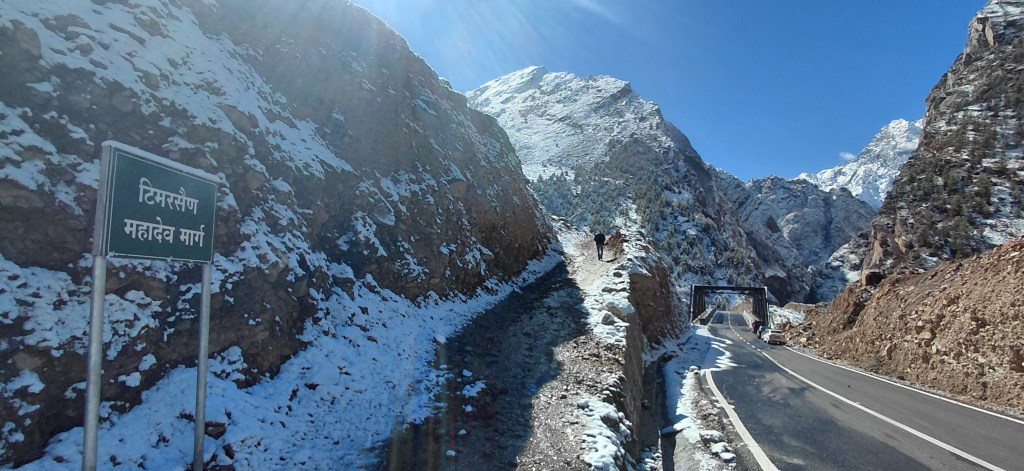
The road from Ghamsali enters a steep turn into a deep gorge. I will turn to Smythe’s description of the local relief at this point in my journey: “Half a mile above Gamsali, the Dhaoli valley narrows to one of the grandest defiles in the Garhwal Himalaya. From either bank of the Dhaoli river the precipices rise smooth and sheer, as though sliced by a titan’s knife. Here and there time and weathering have rifted the rocks into chimneys and clefts, which spring upwards as straight as spears for 1,000 feet or more.”
From the turn, it was a few more kilometers to Niti village, which of course at this time of the year (November) was deserted. Having come this far, there was a deep yearning to go further to Geldung, which is 24 km away and the last roadhead before Niti Pass. There are a few vlogs that explore biking from Niti to Geldung, such as this. But overall, this blog by none other than Harish Kapadia is one of the best I could find on this region.
Timersain Mahadev and the return
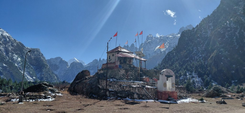
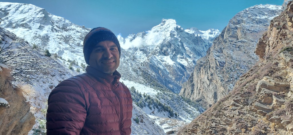
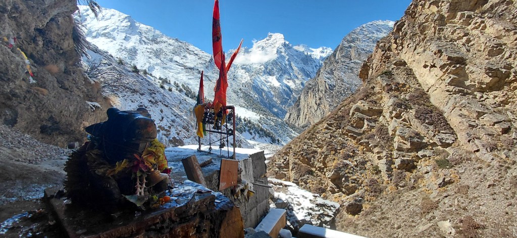
After a quick cup of tea and a few pictures, we were back on our way- but not before and interesting stopover at Timersain Mahadev, also called as Chhota Amarnath as the Shivling, much like the Amarnath Cave Shrine- is formed of ice stalactites and stalagmites. It is a short 2-2.5 km hike from a roadhead close to Niti village. The view of the mountains that form one wall of the Niti valley quite stunning.
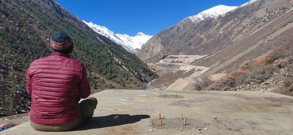
For some time, at the base of Timersain, I sat in a padmasana posture, trying to fill my mind with the imagery that was presenting itself before me. However, I wasn’t moved the way I was at the Pindari Glacier back in May 2025, where what started as tears became a torrent. Nothing of that sort here. This was a clinical trip—for such experiences, one needs more time and immersion. But I really don’t mind it.
As is usually the case, the return was quite uneventful. I was filled with deep satisfaction for having come here, and this far. A silent promise- that I will come soon again.
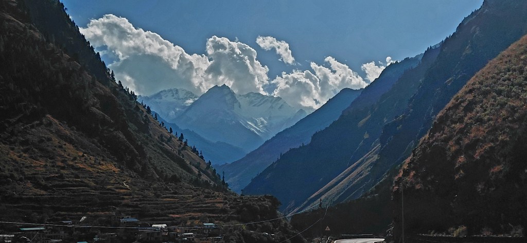
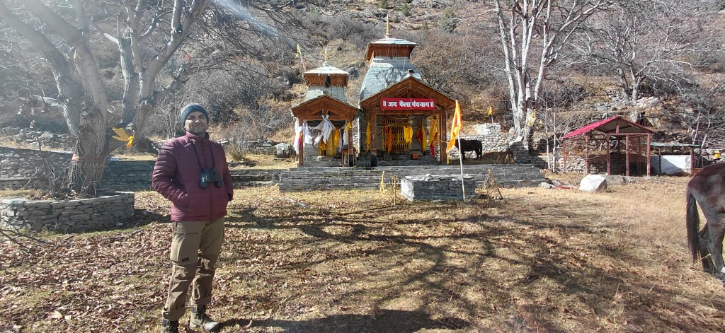
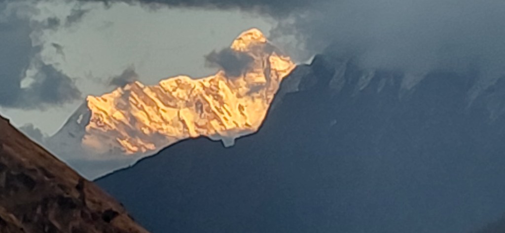
The highlight of the return trip was the inspiring view of the Dronagiri mountain as the sun set over the western skies, and most of all, the queen of mountains, Nanda Devi, with the Joshimath valley in the foreground. I made a brief stopover at the Bhavishya Badri temple, which, as per local folklore, will be where Vishnu will reside in the future. As per this belief, the arm of the Narsimha idol in the Narsimha temple is gradually growing thinner, and the day it falls off, a major ecological event will destroy Badrinath and Vishnu will emerge at Bhavishya Badri.
In my next blog I will cover the 2nd part of the trip- the trek to Kuari pass.

Leave a comment